
Yellowstone National Park
[rating stars=”5.0″]
 Yellowstone National Park is the wild, free-flowing, beating heart of the greater Yellowstone ecosystem. Its real showstoppers are they geysers and hot springs but at every turn this land of fire and brimstone breathes, belches and bubbles like a giant kettle on the boil. Yellowstone is split into five distinct regions, Canyon Country, Geyser Country, Lake Country, Mammoth Country and Tower-Roosevelt Country, each with unique attractions. The park’s highways traverse these geysers, through meadows and forests, past roadside herds of bison and campsites aromatic with pine needles and family campfires. In between lies the country’s largest collection of elk, the continent’s oldest, largest wild bison herds and a pristine wilderness roamed by wolves, grizzlies, moose and antelope. For thousands of years, Yellowstone’s unique landscape has changed in ways both dramatic and minute. There’s certainly no bad time to visit Yellowstone. Open ten months out of the year, there’s something new to experience in any season. And while some elements like wildlife and weather can be unpredictable, one thing is for sure. Whether you’re visiting for the very first time or you’ve come back again and again over the years, you’re in for a treat whenever you set foot in the park.
Beneath the boardwalks tourists criss-cross to see the park’s thermal features, under the rolling rivers and the paws of bears and wolves is a vast super caldera, the mouth of a series of massive eruptions, the last of which occurred as recently as 630,000 years ago.
If you stay attached to your car…
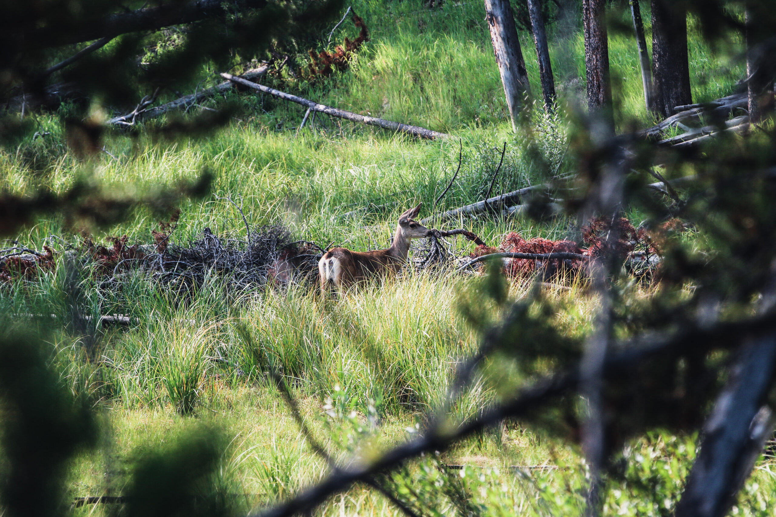
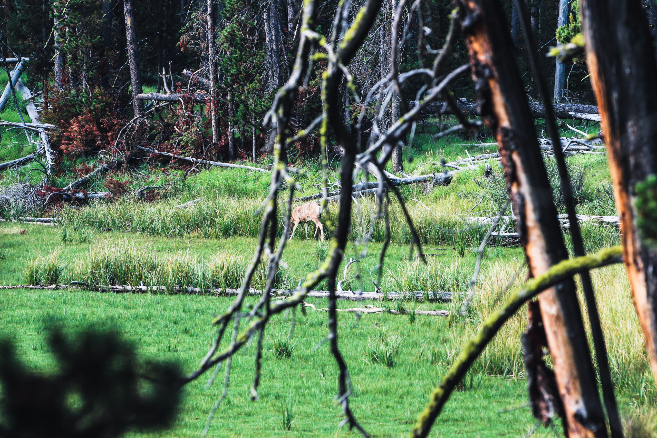
If all you do when you visit Yellowstone is drive from major attraction to major attraction you are only going to see and experience less than 2% of Yellowstone. Jen and I were determined to not visit and just visit the major tourist favorites, we decided that we would commit to getting out of the car and hitting the hundreds of trails. Granted we didn’t hike those hundreds of trails, but every opportunity we had to get out and onto a trail in a particular distinct area of Yellowstone we did just that.
Day One:
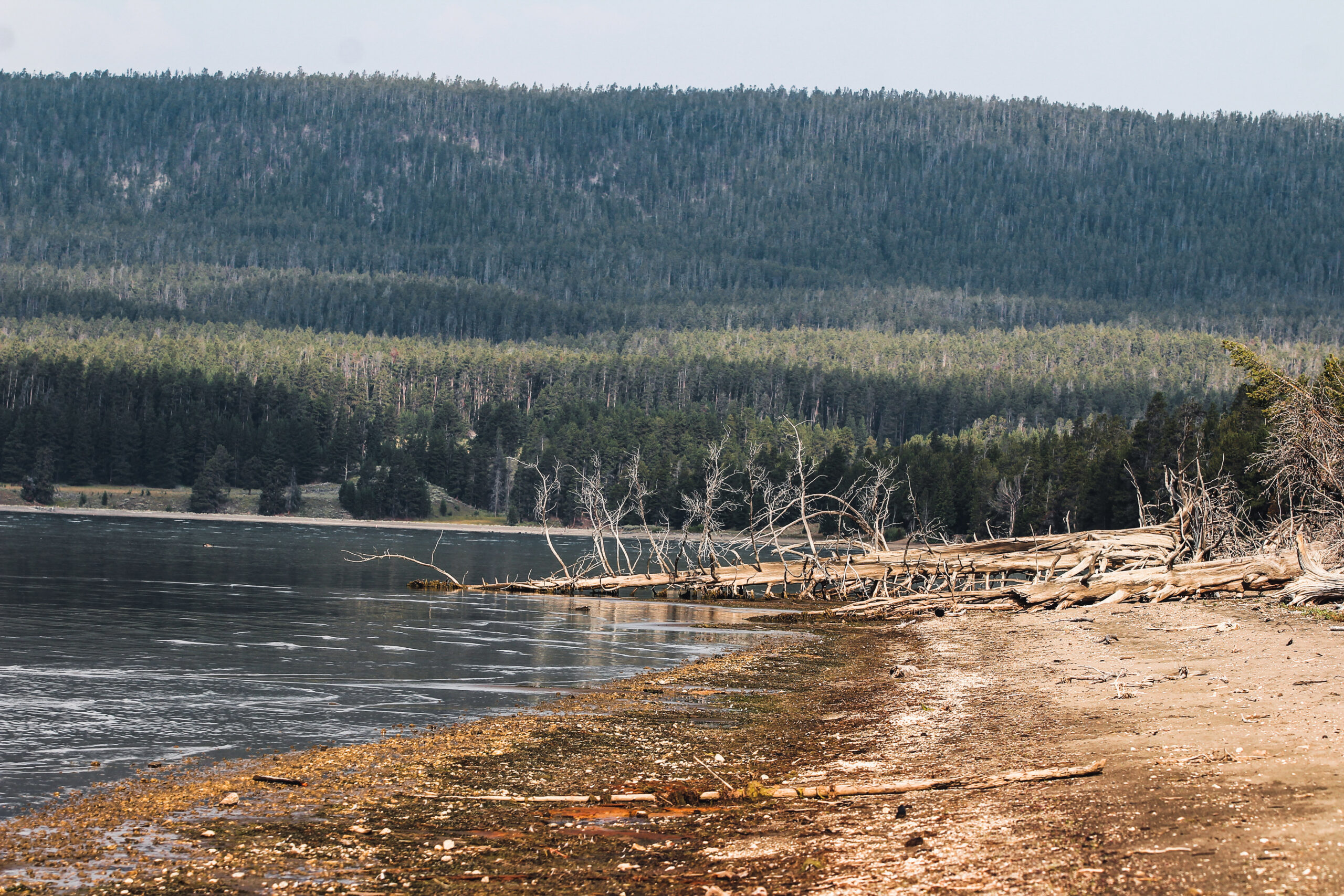
Our first day at Yellowstone was August 25th. We got up fairly early, and drove the 18 miles to the east entrance of Yellowstone. The east entrance road is so scenic and beautiful, and our first stop was Lake Butte elevation 8733 ft, its about 15.7 miles from the east entrance. Just before you reach Yellowstone lake there is a road to the right called Lake Butte Scenic Drive that takes you to a view point that allows you to get a great view of Yellowstone Lake.
From Lake Butte Overlook, Jen and I didn’t travel too far down the road before stopping at Yellowstone Lake Sedge Bay.
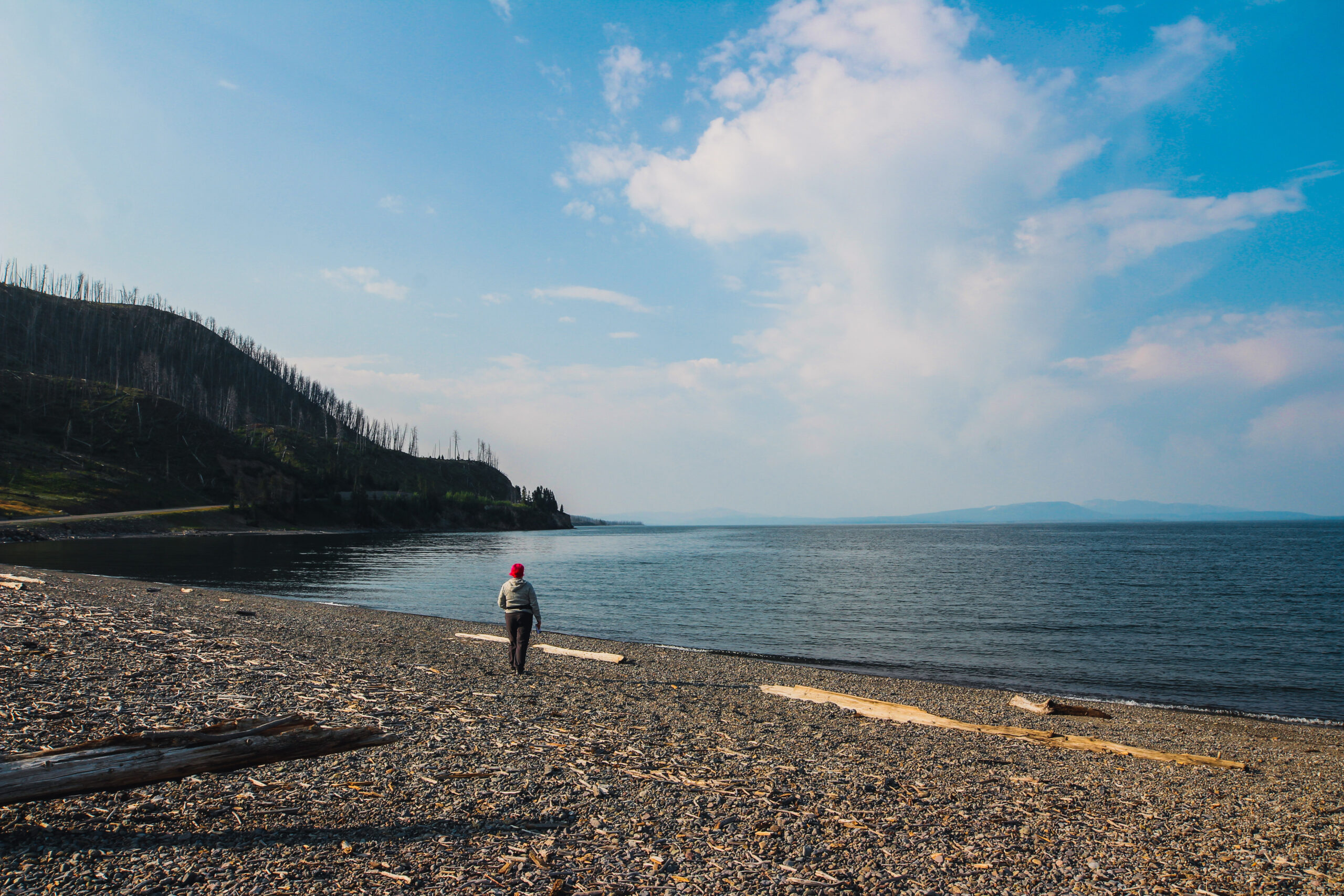
From Yellowstone Sedge Bay, we headed down the road to the Pelican Creek Nature Trailhead, and we decided to take a quick and easy 0.6 mile (1-km) loop trail hike that travels through the forest to the lakeshore before looping back to the trailhead. It is a scenic introduction to a variety of Yellowstone’s habitats and is a good place for birding. A frequent reminder that you will get from my reviews of Yellowstone is that you are in bear country, and hiking in groups of 3 or more and keeping your group together is important. Tell someone where you are going and when to expect to return. Know your route, carry a map, and be able to navigate. Do not hike after dark. Stay on established trails; off-trail travel is prohibited in thermal areas.
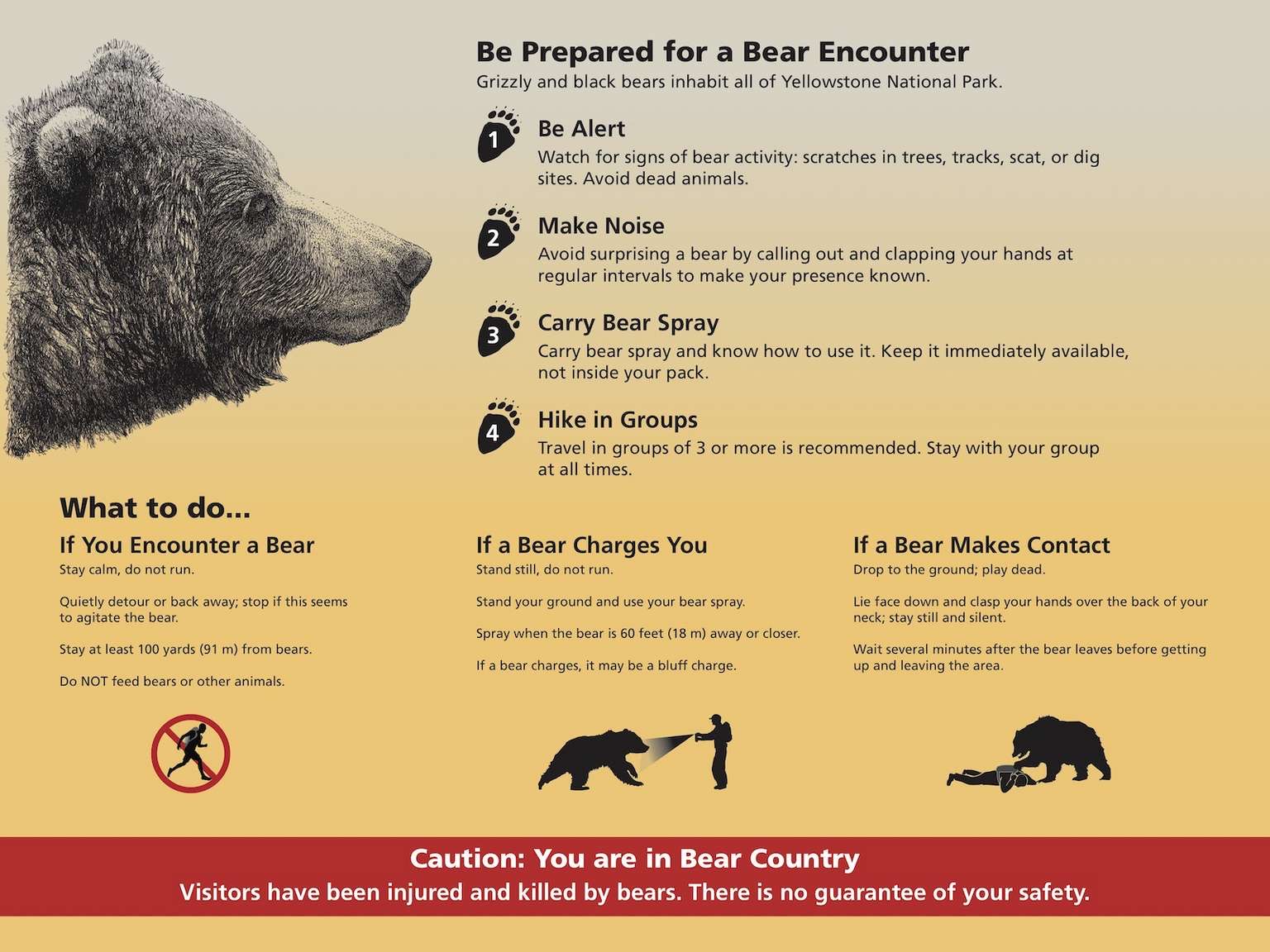
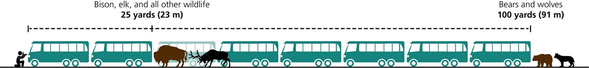
While in the park pay attention to posted signage, it is there for your benefit and provides you with some valuable information on how to stay safe and enjoy your time in Yellowstone National Park, sadly this advice can’t be stressed enough, while we were there we saw many instances of visitors simply ignoring the warning and doing just whatever they please, so much that I stopped and told one woman her husband was violating federal law. Granted it can be a challenge in some areas where you might run into Bison to give them the 25 yards suggested. But even then you need to respect these magnificent animals and give them as much space as possible.
It was while we were at Pelican Creek Nature Trail along the lakeshore that Jen and I spotted our first evidence of bear activity, we found some bones of some fish and some tracks along the shore, there were elk, bison and wolf tracks also. But the area is definitely a prime area for bear activity, and we definitely wanted to get a change to watch a grizzly or black bear from afar.
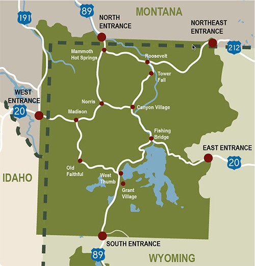
Just up the road from the Pelican Creek Trailhead, you will discover the Fishing Bridge General Store, and next to that is the Fishing Bridge Gas and Service Station, really convenient when you consider the how big Yellowstone is (3472 sq miles) and Grand Loop Road which is 140 miles long, running through the major features of the park, curving around in a figure-eight past the park’s most striking natural feature, its nice to know you can get gas in the park boundaries.
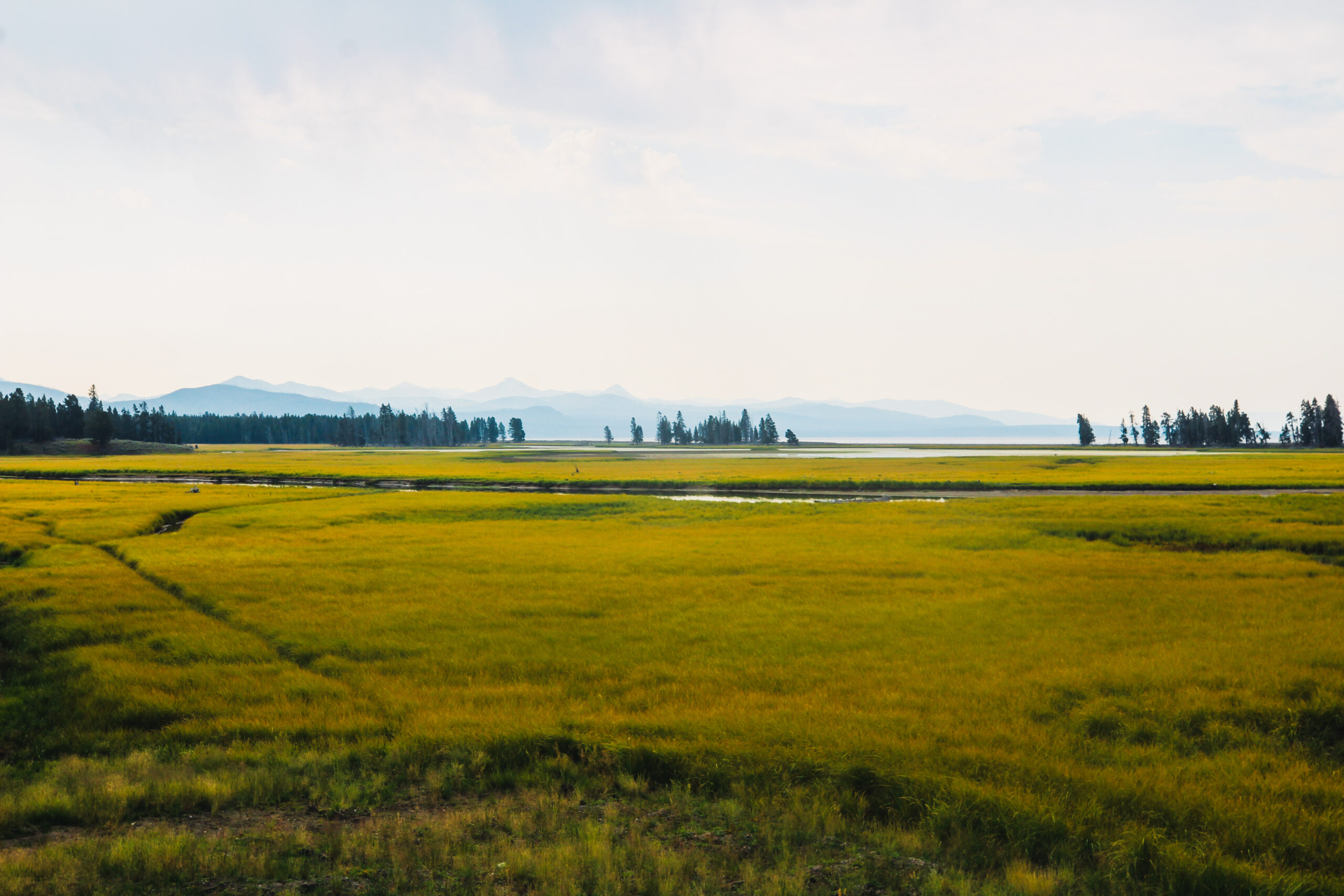
Due to Covid-19 masks were required inside Fishing Bridge General Store, the store was laid out nicely and had plenty to offer, we picked up some snacks and some items we realized we needed back at camp (I had forgot to pack). After getting the Subaru topped off, we headed across fishing bridge and this is where the East Entrance Road runs into the Grand Loop Road, our planned destination was the Grand Canyon of Yellowstone, so we took a right and headed into the famed Hayden Valley. Here are some of the photos we capture along our route.
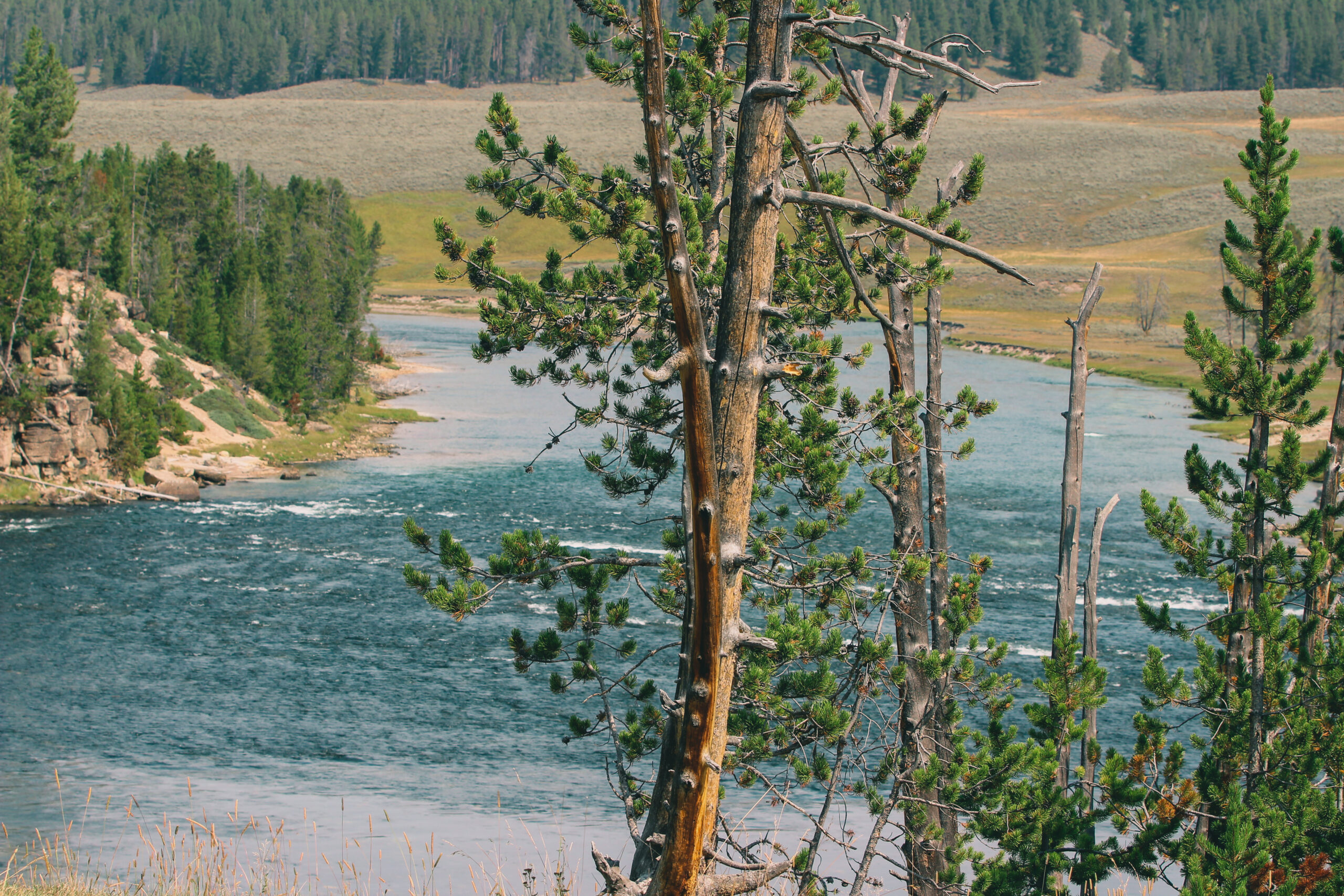
LeHardy’s Rapids, located on the Yellowstone River, the longest undimmed river in the contiguous United States. In the Spring, you might be able to see Yellowstone cutthroat trout leaping upstream at LeHardy’s Rapids. Yellowstone cutthroat trout are the most widespread native trout of the park and were the dominant fish species here prior to Euroamerican settlement.
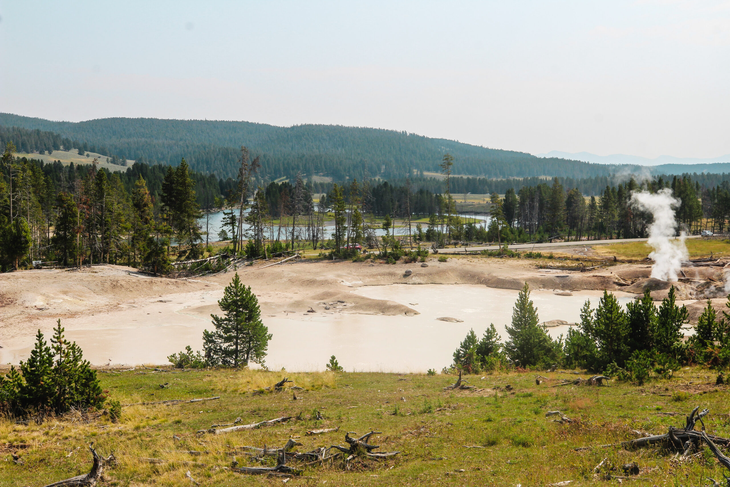
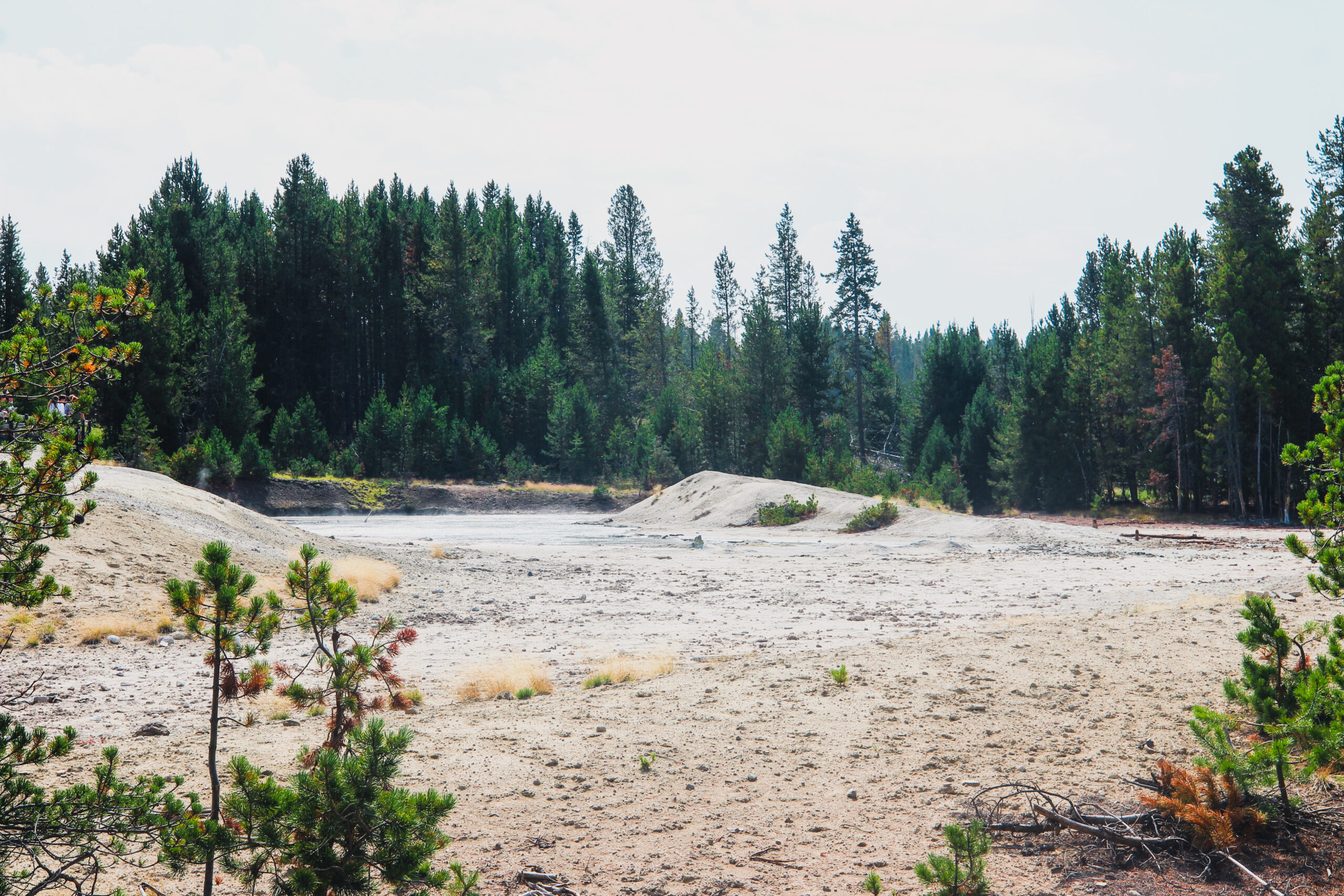
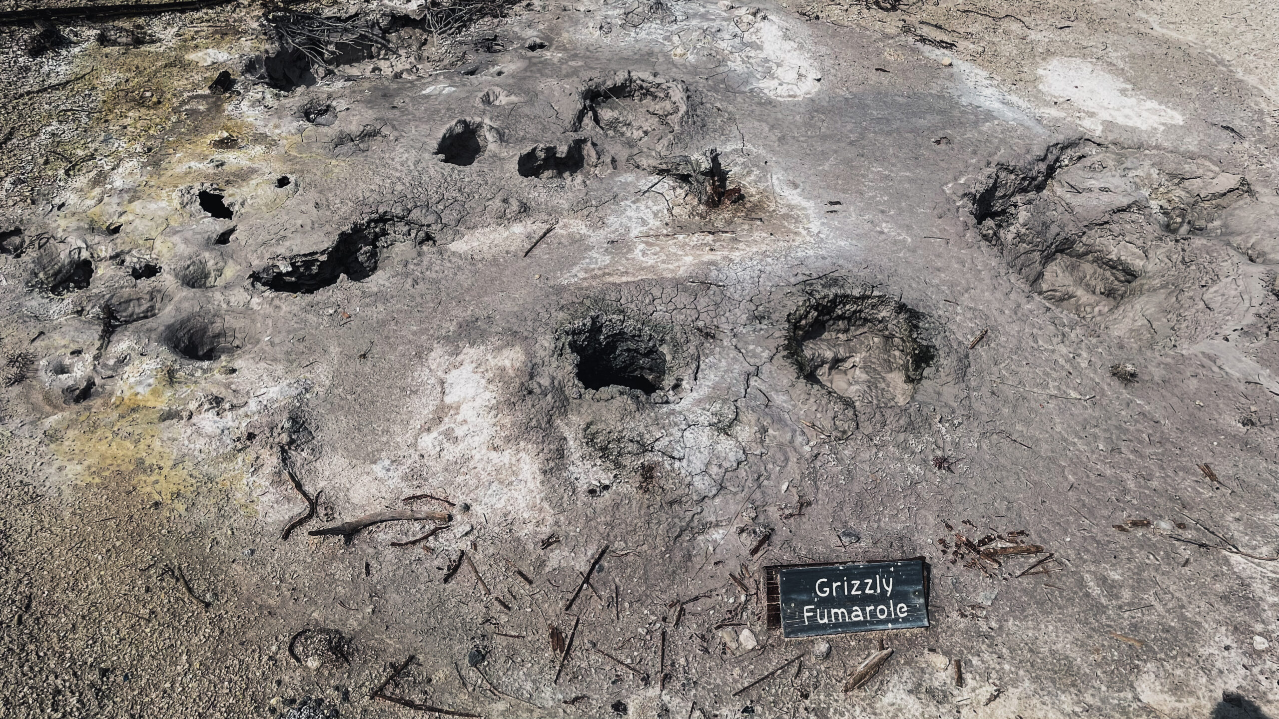
Just up the road from LeHardy’s Rapid is a your first change to check out a really neat thermal area called Mud Volcano, there is a trailhead there that is worth stopping, stretching the legs, grab the bear spray and a water bottle and check out Mud Caldron, Mud Geyser, Sizzling Basin, Churning Caldron, Black Dragons Caldron, Sour Lake, Grizzly Fumorale, Mud Volcano and Dragons Mouth Spring. Warning, this is a thermal area, please stay on the provided trail (Boardwalk). Early explorers to Yellowstone described this feature as a “most repulsive and terrifying site.” It is a volcano-like cone, 30 by 30 feet high and wide (9 x 9m) with mud that erupts and covers tall trees. When Nathaniel P. Langford, the first superintendent of Yellowstone, visited in 1870, he saw “a seething, bubbling mass of mud.”
It is likely a violent eruption blew out the cone’s side, leaving the crater you see today. The water constantly undercuts the back wall and is rich in iron sulfides. This entire hiking trail is easy two-way looped boardwalk that take you up a small grade, you get a decent distance from the roadway and its a great spot to see many of the wonders in this area of the park. Well worth adding to your list of spots to stop. There is a decent amount of parking, and plenty of vault toilets.
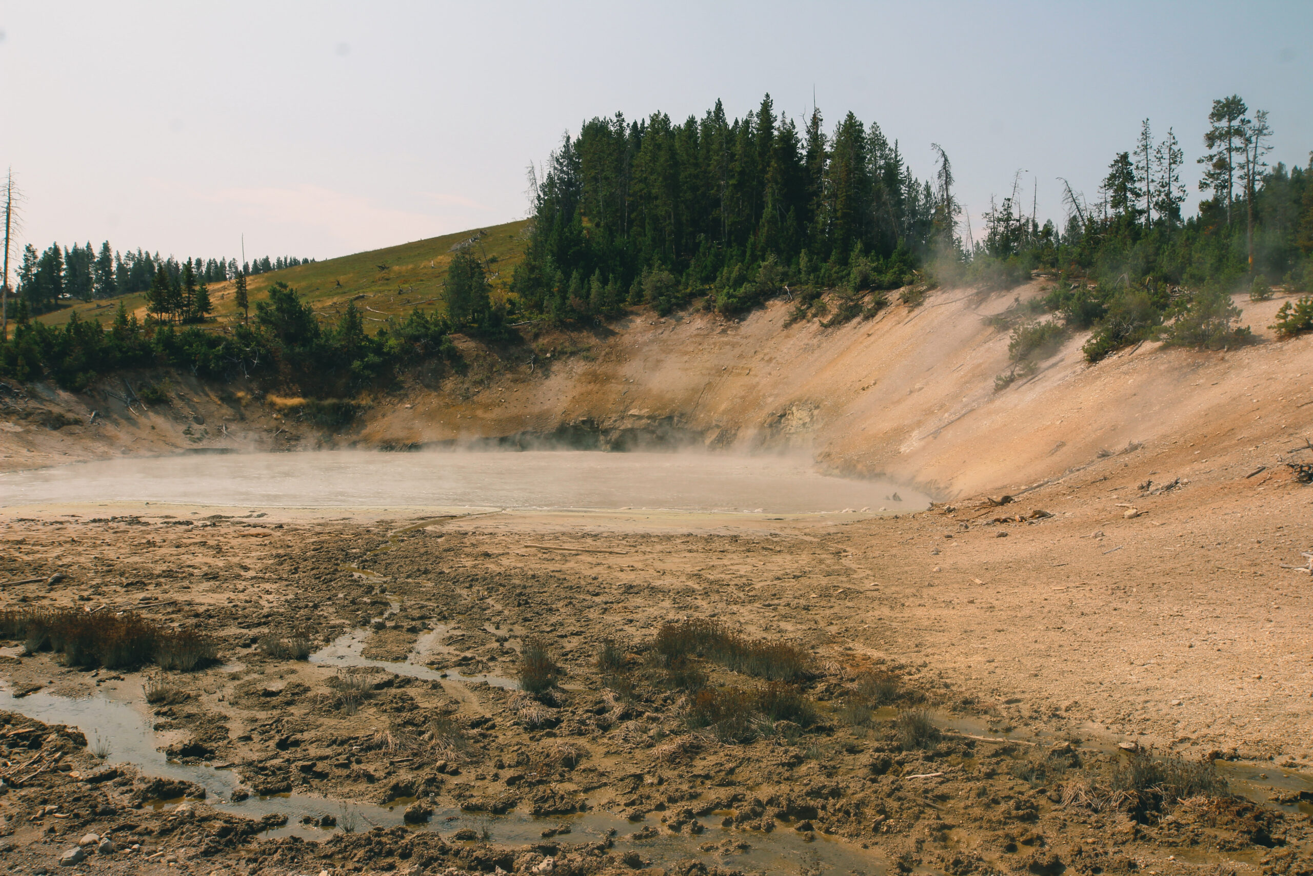
Mud Geyser once the main attraction, this feature once shot mud up to 50 feet (17m) into the sky. However, it effectively died in the 20th century. Today, some activity has returned to the area.
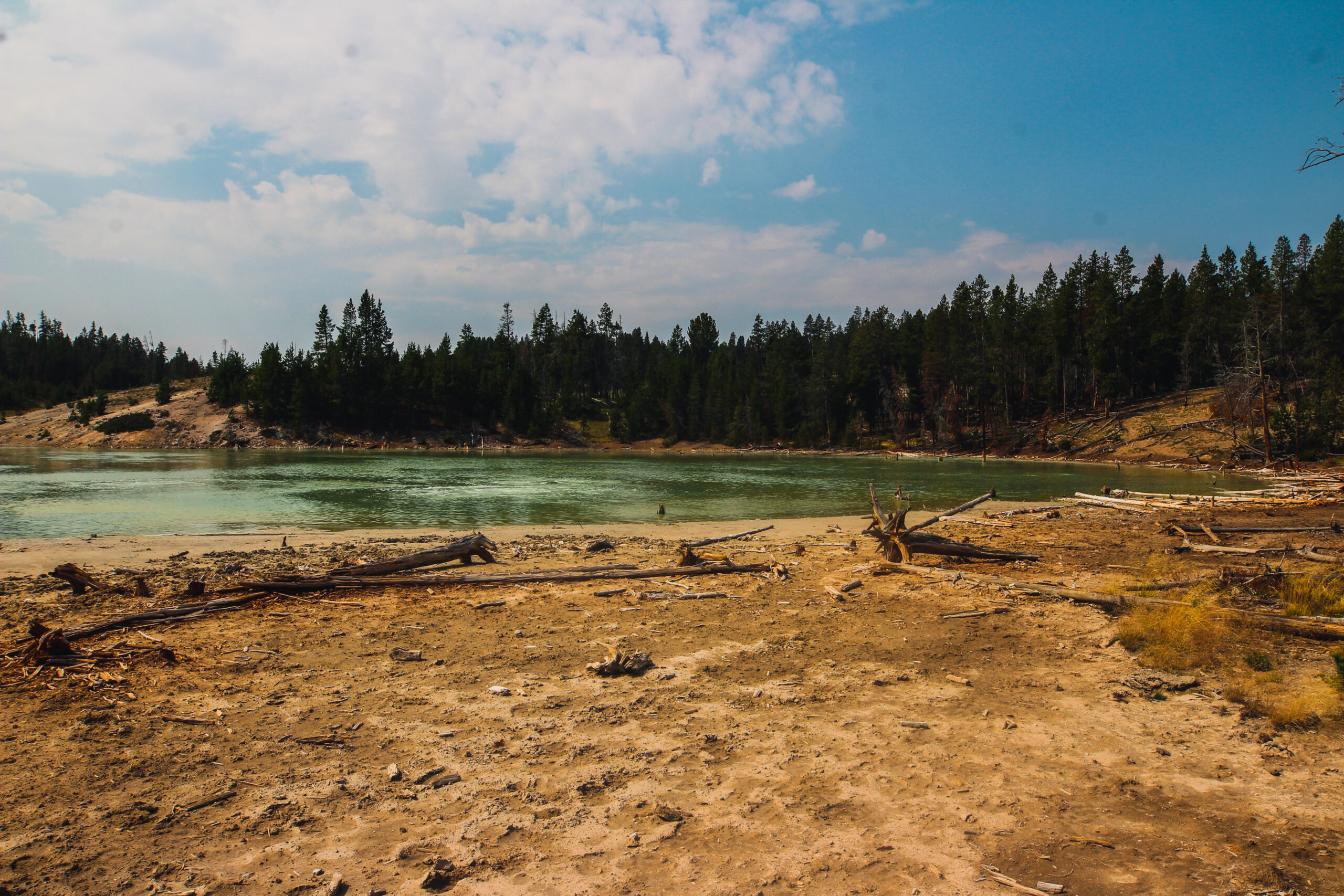
Sour Lake is an extremely acidic lake, a result of the microorganisms making use of the high levels of sulphur in the area. Sour Lake and Black Dragon Caldron are close by each other. In 1948, Black Dragon’s Caldron burst through a crack in the earth. It uprooted and coasted nearby trees with thick mud. Since then, this muddpot moved south 200 feet (60m) along the crack. The spring feeding nearby Sour Lake was much more active before Black Dragon’s Caldron formed. Perhaps underground changes diverted heat energy from Sour Lake to form this muddpot, which a park ranger name for its color and the apparent lashing of the “dragon’s tongue.”
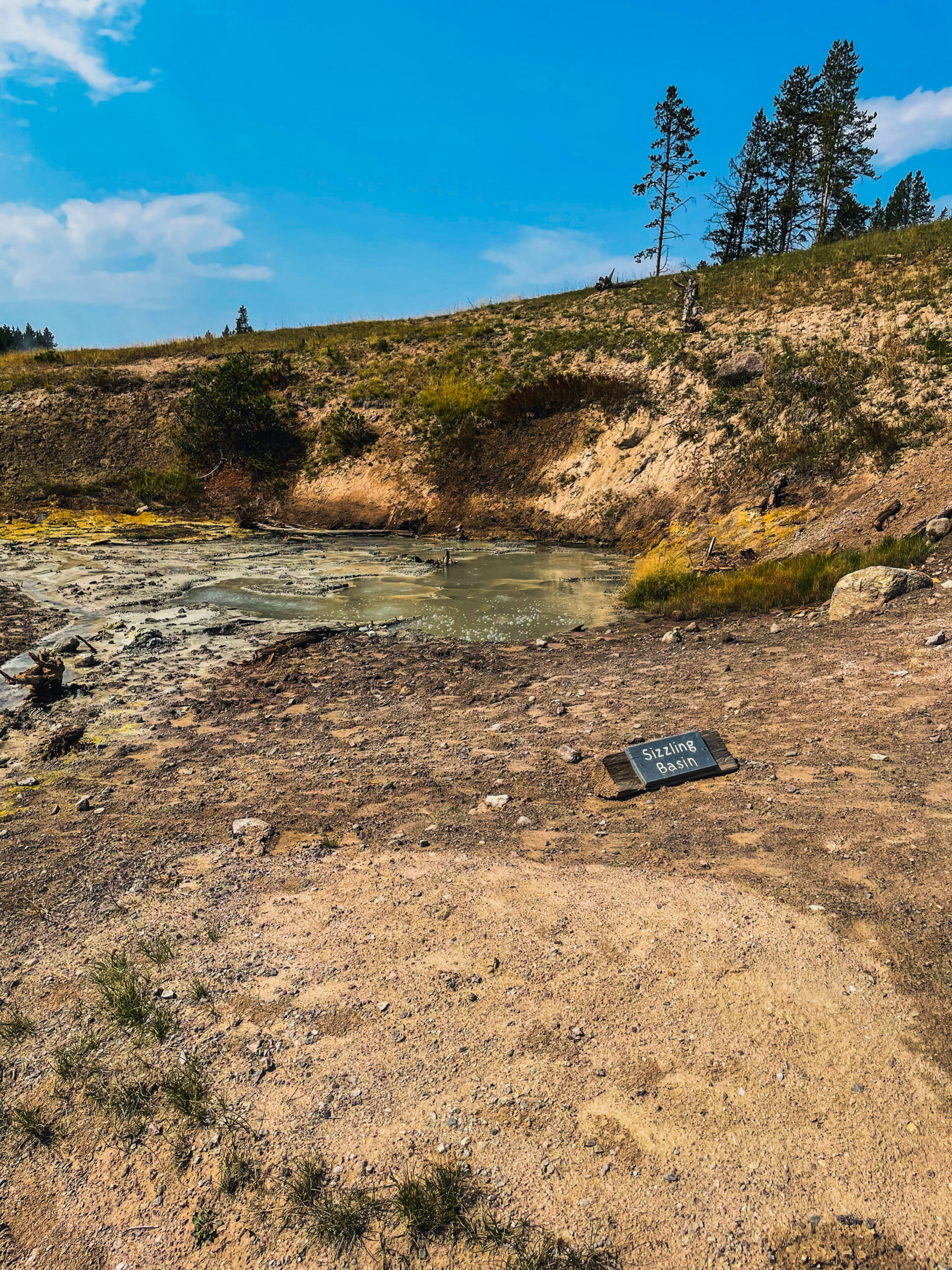
Sizzling Basin is a hot spring that has existing activity much like grease on a hot frying pan.
Now this one is interesting, Grizzly Fumarole while named a fumarole, this feature will change based on recent precipitation. When dry, it is a fumarole. When it has been rainy, this feature can be a mudpot.
From Grizzly Fumarole, you walk down the boardwalk and then take a left to a little elevated portion to see Dragon’s Mouth Spring, this one I thought was super cool. The Crow Indians saw the steam from this mudpot as snorts of an angry bull bison. An unknown European American gave it the current name. Its previous names include Gothic Grotto, Blowing Cavern, and the Belcher.
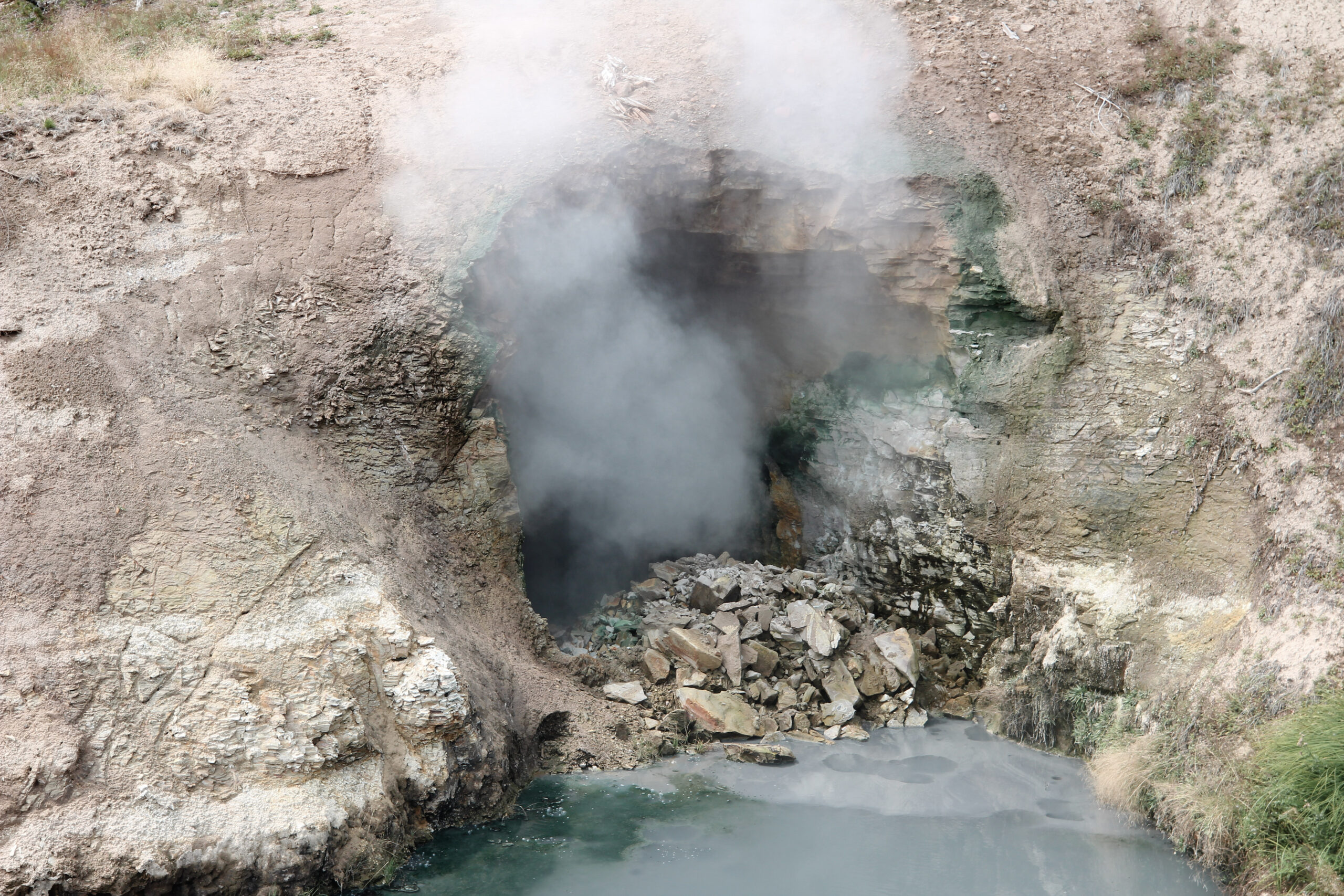
The surging action you can hear has decreased since 1994, though no one is sure why. In 1999, more dramatic changes occurred: the water temperature dropped 10 degrees and the color changed from green to the chalky white you see above in the video.
Hot Springs
Hot springs are the most common hydrothermal features in Yellowstone. Their plumbing has no constrictions. Superheated water cools as it reaches the surface, sinks, and is replaced by hotter water from below.
This circulation prevents water from reaching the temperature needed to set off an eruption.
The Smell
Mudpots are acidic features with a limited water supply. Some microorganisms use hydrogen sulfide, which rises from deep within the earth, as an energy source. They help convert the gas to sulfuric acid, which breaks down rock to wet clay mud and creates the smell you experience through out the Mud Volcano area. The pungent odor of rotten eggs is cause by the hydrogen sulfide gas.
Mud Volcano Area
The Mud Volcano area has many mudpots and hillsides strewn with trees cooked by steam. The hydrothermal features here are some of the most acidic in the park. Mud Volcano is near the greatest uplift and sinking of the Yellowstone Caldera floor. Many faults converge here and earthquakes are common.
The areas surrounding the Mud Volcano vent and the other major vent near Old Faithful are called resurgent domes. Resurgent domes are active ground deformation, where the land moves up or down with the fluctuation of the magma chamber below. USGS Scientists monitor these domes closely for information about ongoing volcanic activity.
The final feature you will see here is Sulphur Caldron and is one of the most acidic hot springs in Yellowstone. Sulphur Caldron’s turbulent waters have a pH approximately 1-2, which is similar to car battery acid or stomach fluids. Its name comes from the large amounts of free sulfur in its waters.
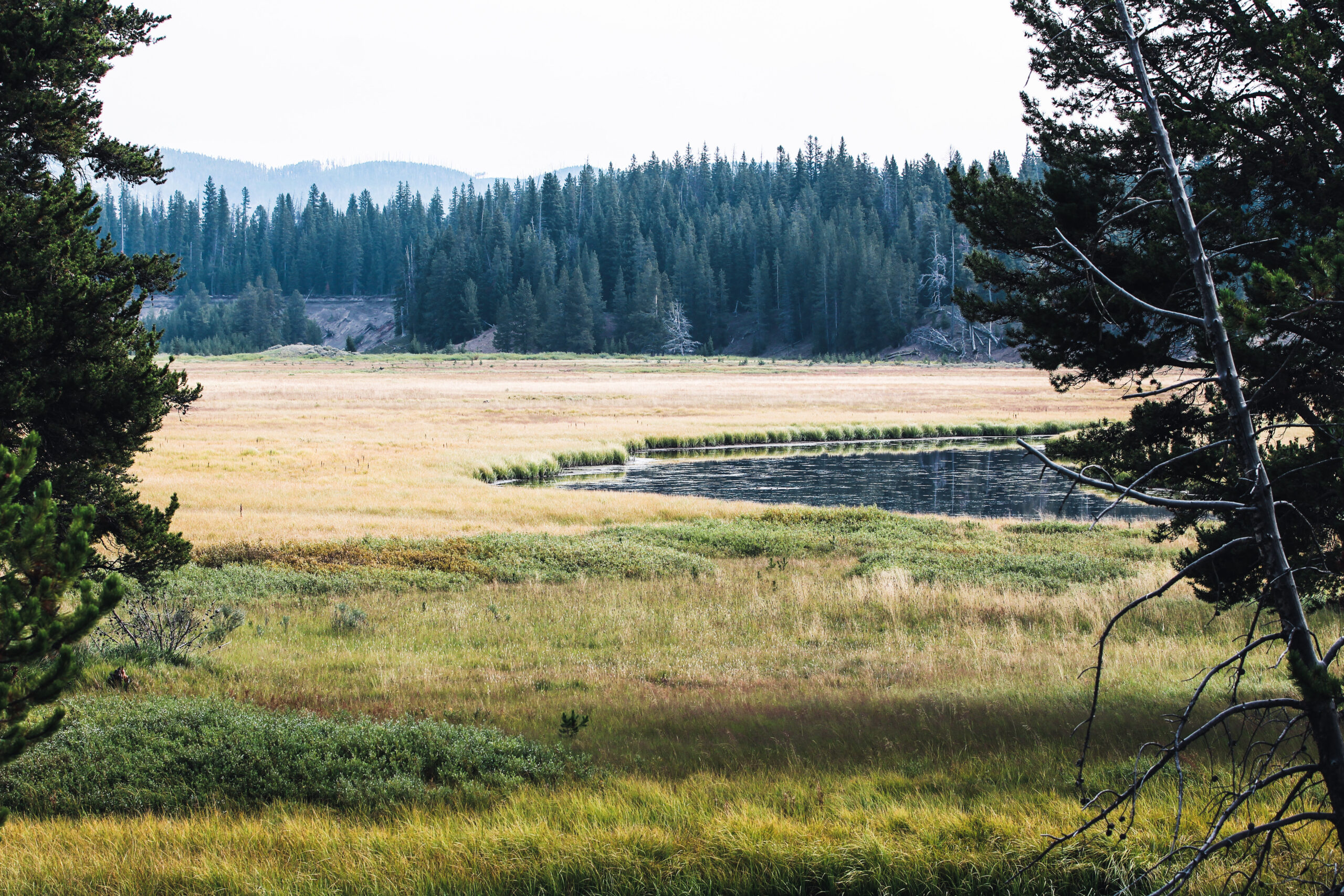
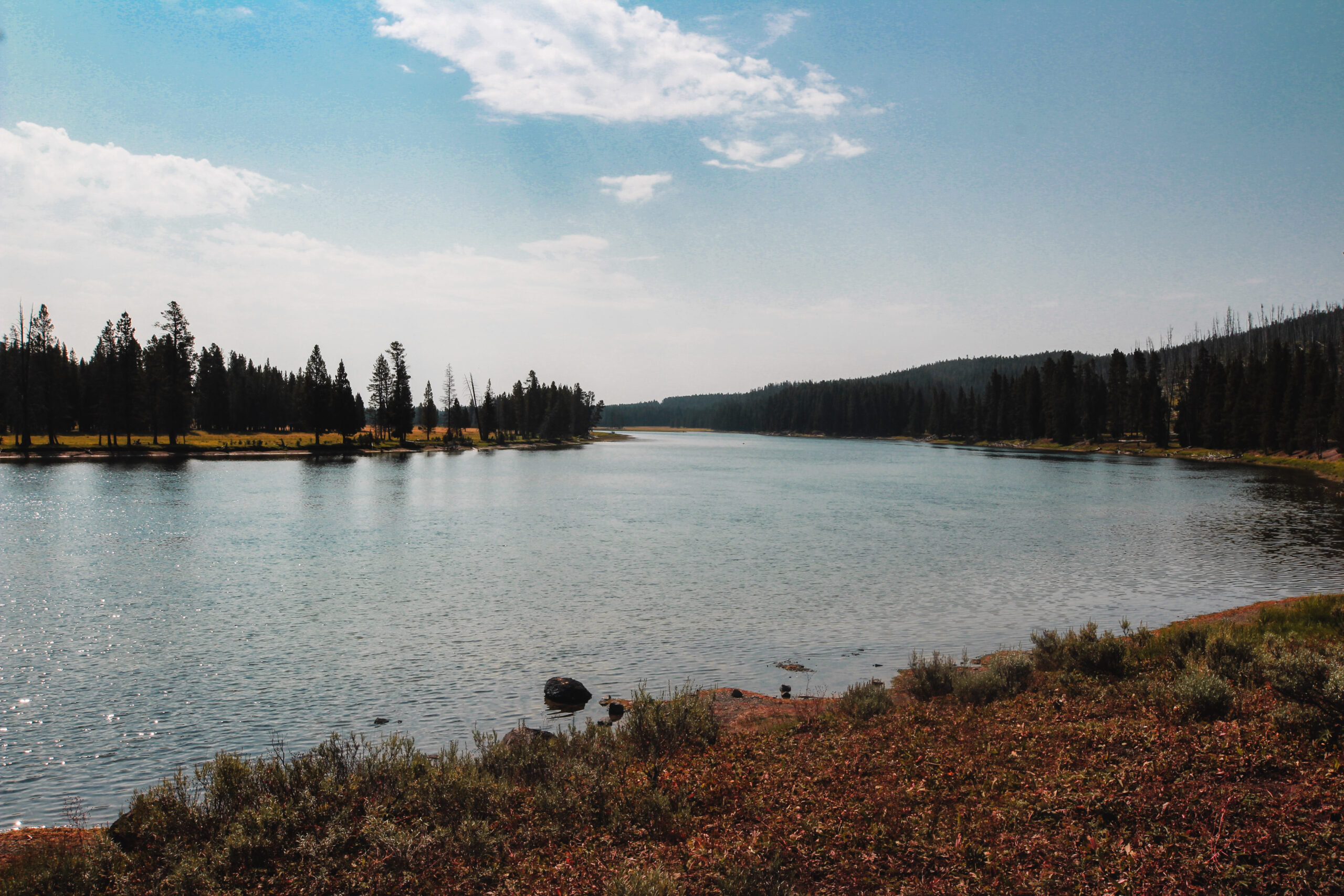
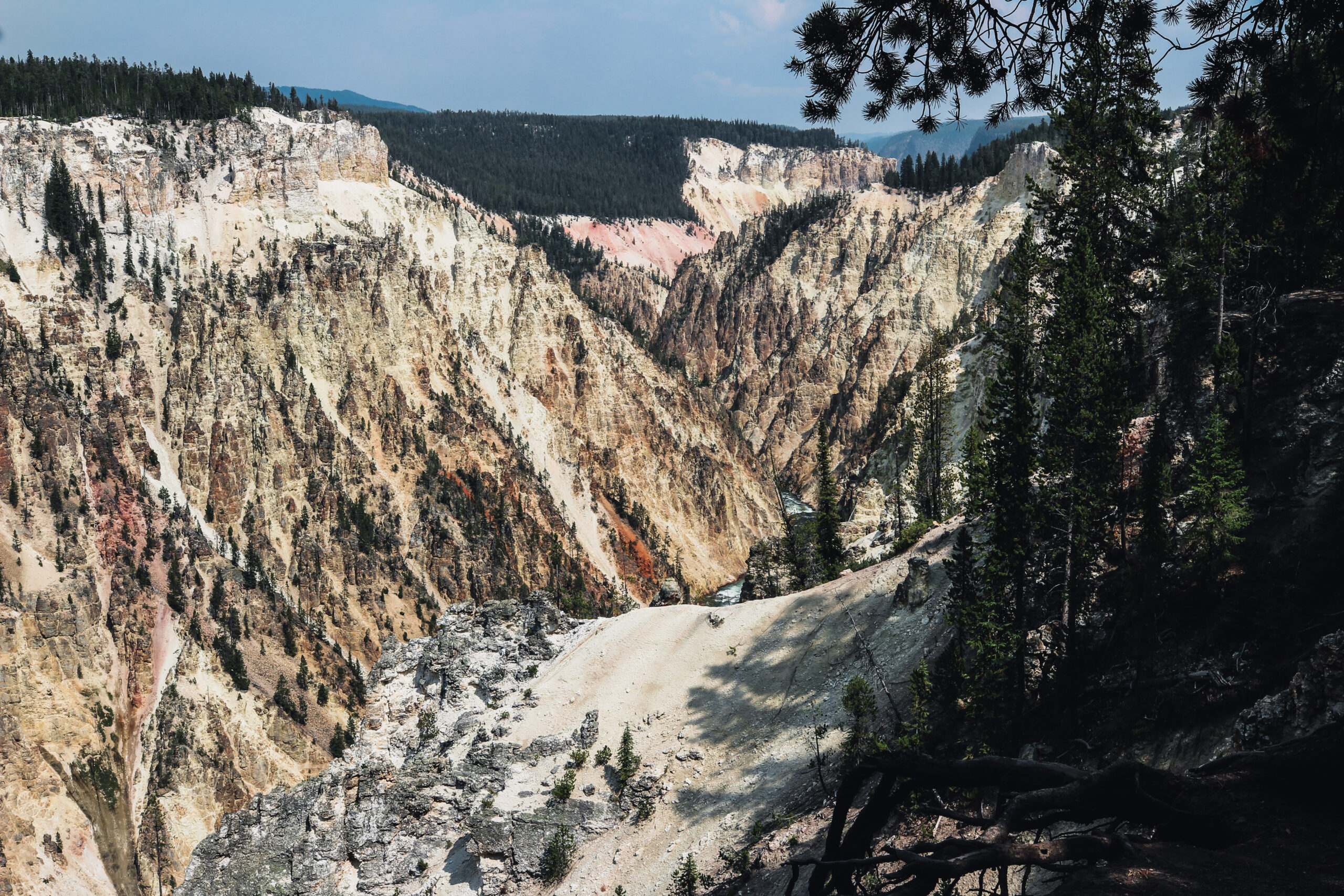
From the Mud Volcano area Jen and I headed into the famed Hayden Valley. Jen and will discuss Hayden Valley later in the review, as we devoted a significant amount of time here later in the trip. We headed from Mud Volcano up to the Grand Canyon of Yellowstone’s South Trim Trail. When you head up South Rim Drive there is a parking lot to the right that you can stop at and get this great view of the Yellowstone River.
From the Wapiti Lake Trailhead parking lot, you take a right and head up South Rim Drive to Uncle Tom’s Trailhead parking lot. Jen and I planned to hike the South Rim Trail and along the way enjoy the scenery and waterfall. I had originally planned to hike Uncle Tom’s Trail, which has an Ascent of 6′ a Descent of 358′ its high is 7,776′ and its low is 7,423′, unfortunately when we go there, we discovered there had been some trail damage (downed trees) that had not been repaired so we just elected to continue hiking the South Rim Trail.
The South Rim Trail is and out and back that leads you along the edge of the spectacular Grand Canyon of the Yellowstone and affords some of the best views of the Upper and Lower Yellowstone Falls. While others scurry from their cars to the edge for a quick look, you can take time to study the intricate beauty of the canyon walls or listen to the roar of the falls and, thus, truly experience the Canyon.
This portion of the South Rim Trail from the Upper Falls Overlook to Artist Point has some of the best views of the canyon without as many dangerous drop-offs as the North Rim Trail.
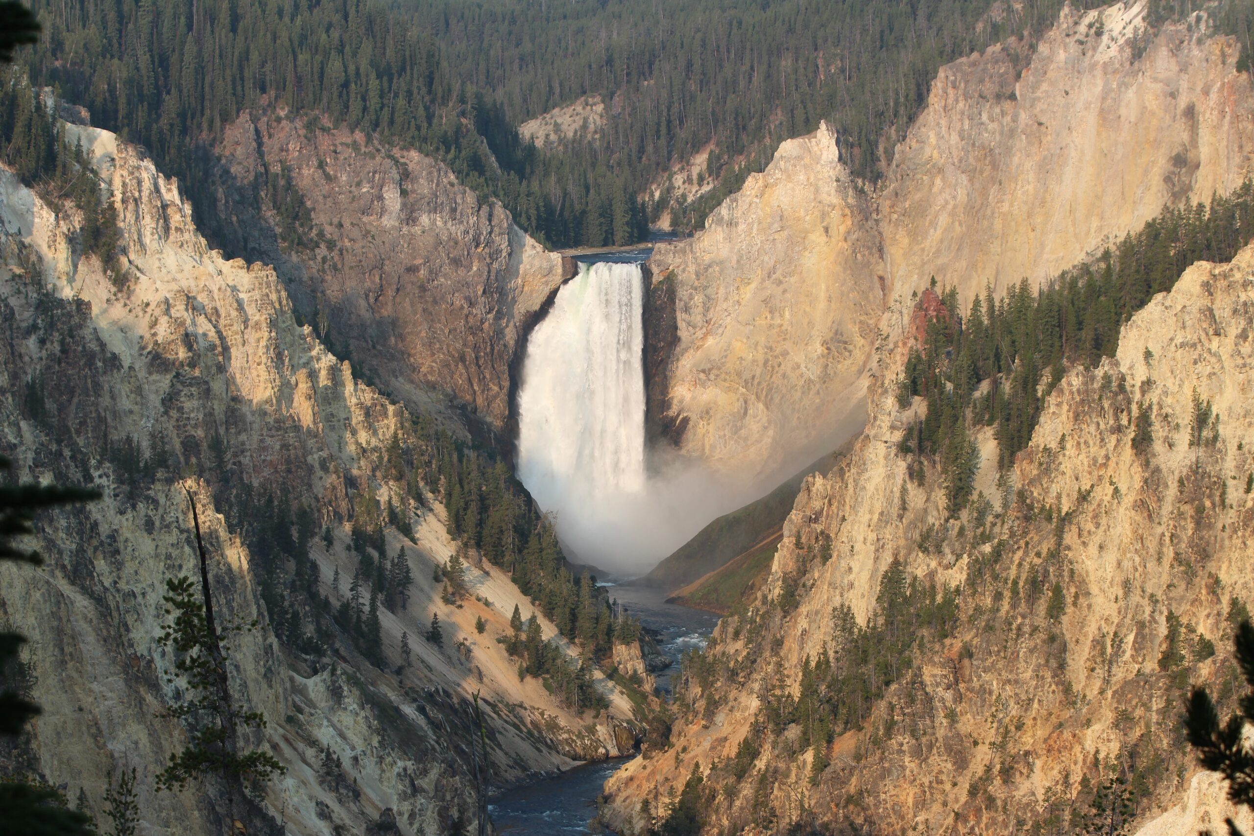
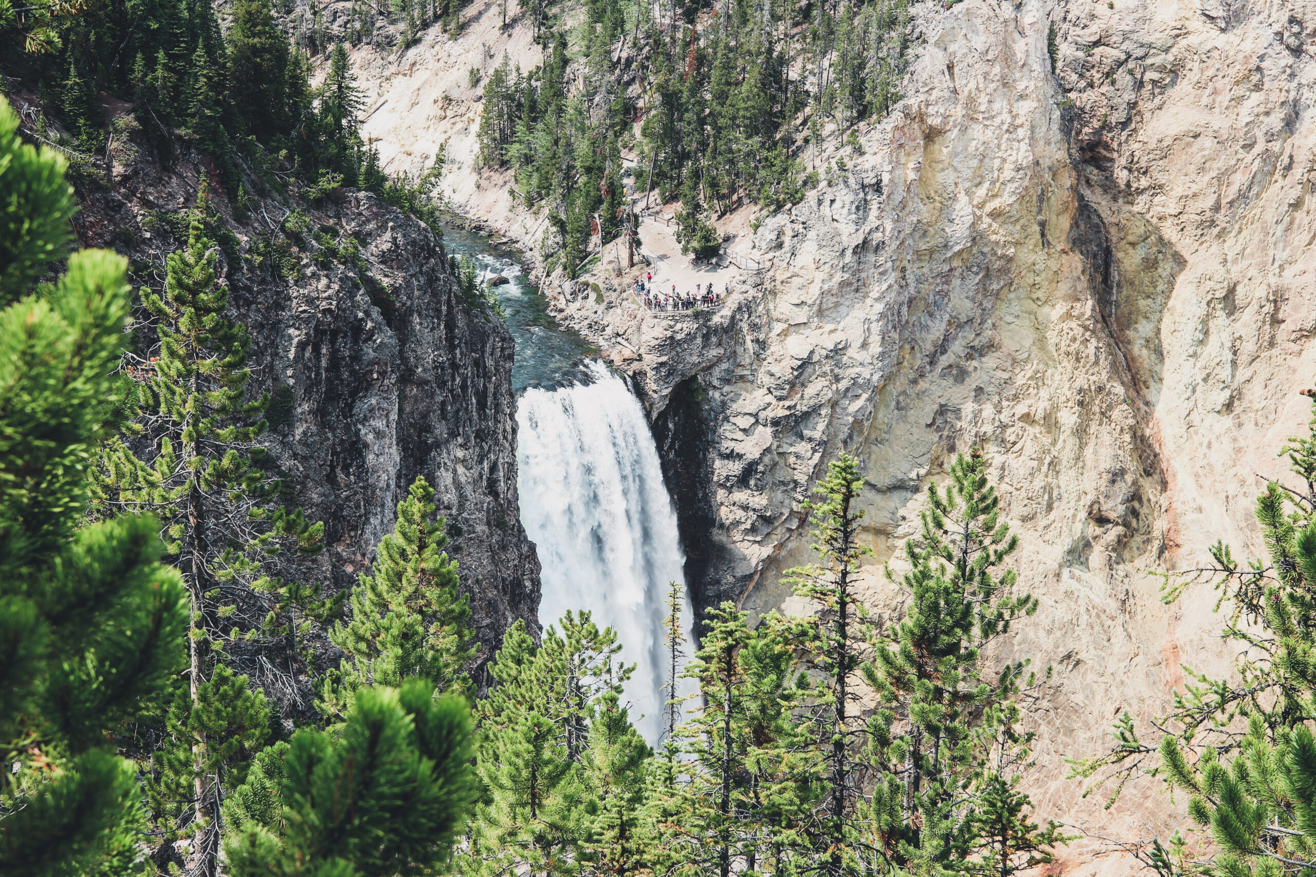
The trail begins at the parking area for Uncle Tom’s Trail/Upper Falls Viewpoint. Follow the walkway from the left side of the parking area to the Upper Falls Viewpoint. Although you are likely to experience crowds here, it is still the best place to view Upper Falls. The falls spills 109 feet over a dense rhyolite lava flow that is resistant to erosion. Immediately downstream, a much softer rhyolite, containing larger amounts of volcanic glass, was more easily eroded by the river.
From the viewpoint turn right and follow the South Rim Trail as it skirts the canyon’s edge. As you follow the trail, look carefully through the trees to the opposite side of the canyon. Cascading through the lodgepoles, down the far wall, is the lovely 129-foot Crystal Falls. The trail loops back to the right an at the 0.4- mile mark you reach the turnoff for Uncle Tom’s Trail. This optional side trail descends more than 300 feet in 0.3 miles to the bottom of the canyon. It is the oldest and most famous trail into the canyon, and the closest trail to the face of Lower Falls. When originally constructed by Uncle Tom Richardson in the late 1800s, it included a series of rope ladders that scaled down the canyon walls. Today these have been replaced by an incline stairway containing more than 300 stairs.
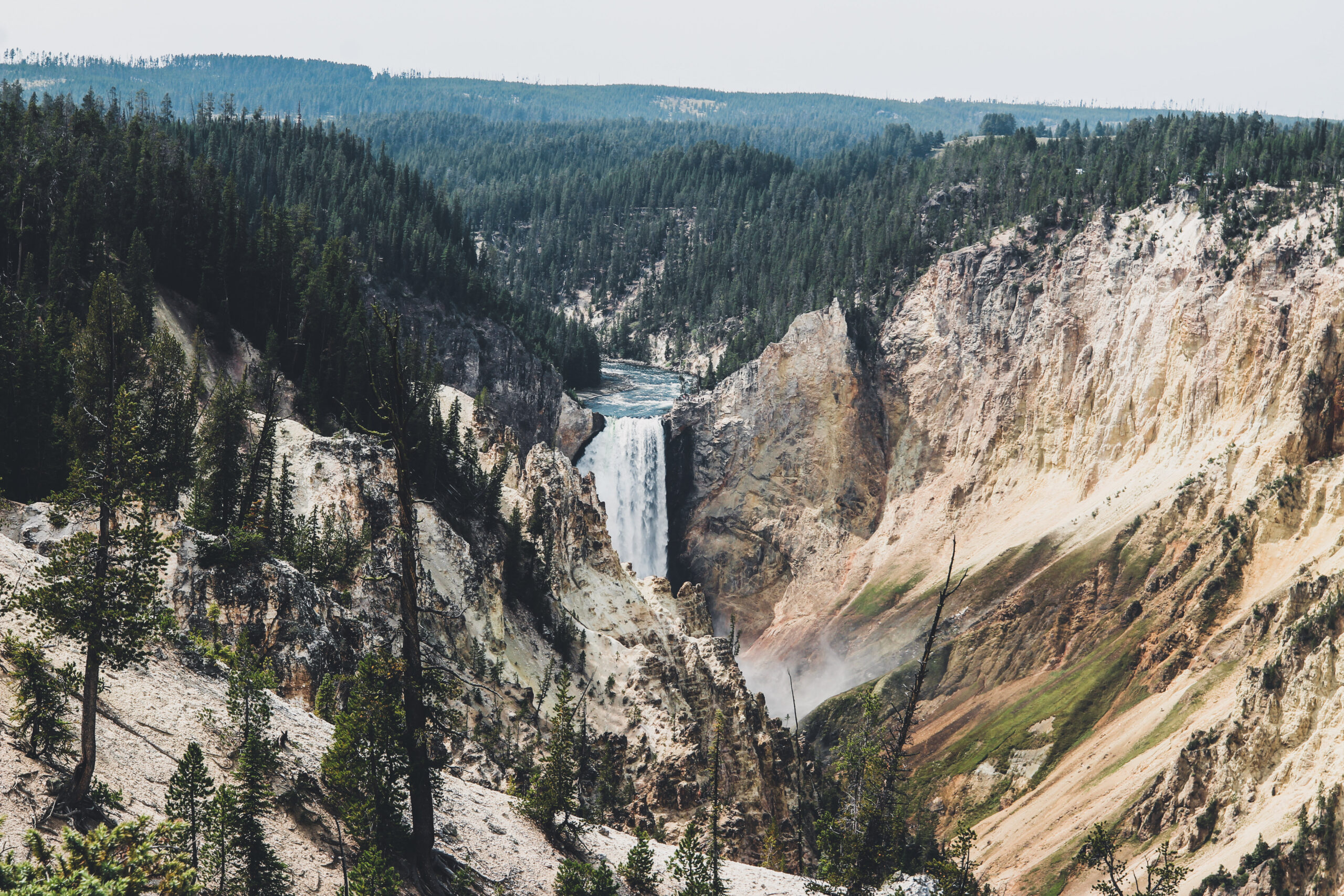
Although heavily traveled, the next section of the South Rim Trail, between Uncle Tom’s Trail and Artist Point, is truly spectacular! Picturesque views of the canyon and Lower Falls await you each time you break out of the trees. As you continue to Artist Point, take a moment to contemplate how this magnificent canyon and falls were created. Hundreds of thousands of years before the canyon was formed, an ancient thermal basin existed. The hot waters altered and weakened the hard rhyolite lava in the area, allowing the river to cut this deep canyon. Today, Lower Falls tumbles 308 feet over a hard, thermally-unaltered rhyolite flow.
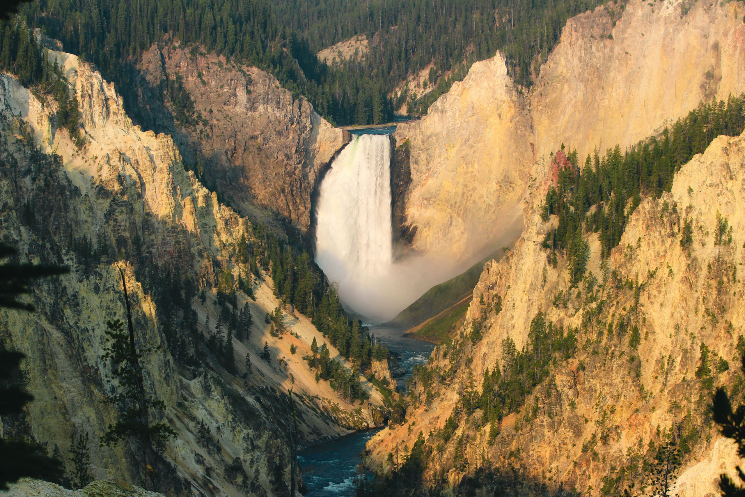
At 1.2 miles you reach the parking area for Artist Point. To reach the point follow the hordes of people northeast through the large parking area, down a few cement steps, and veer left out to the viewpoint. There is a reason this is the most popular spot in the canyon — it has by far the best view! Similar views from the opposite side of the canyon inspired Thomas Moran in 1871 to make sketches and take notes from which he later painted his famous oil of the Grand Canyon of the Yellowstone and Lower Falls.
To finish the route, retrace your steps to Uncle Tom’s Trail parking area. Enjoy the trip, you’ll be amazed how different things will appear when heading in the apposite direction.
And this concludes Jen and me Day One in Yellowstone National Park.
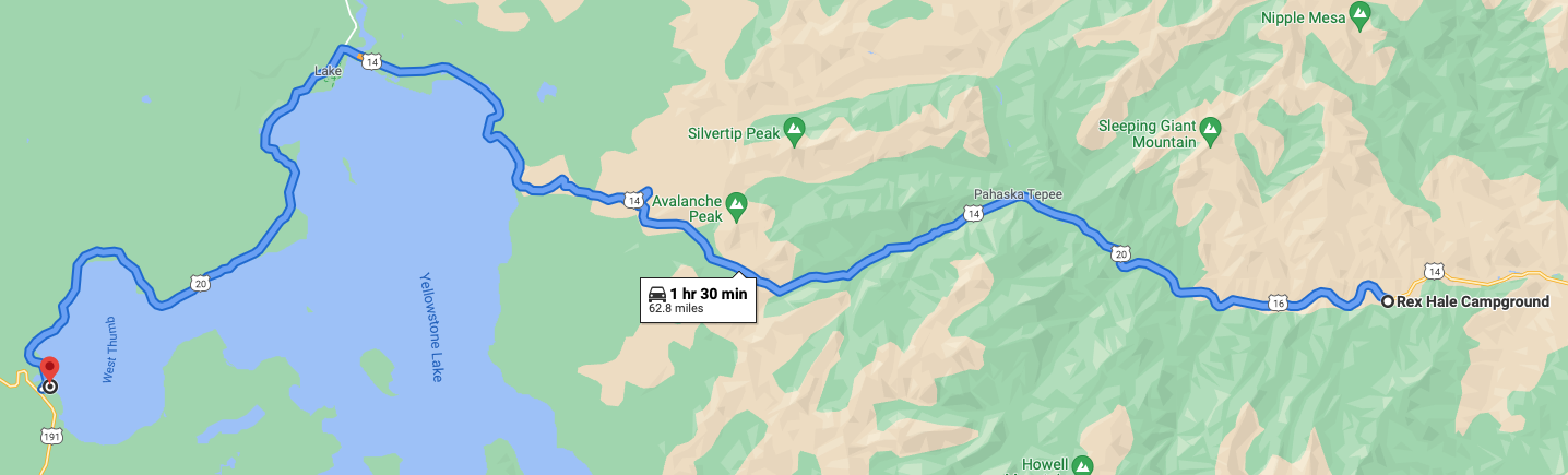
DAY TWO:
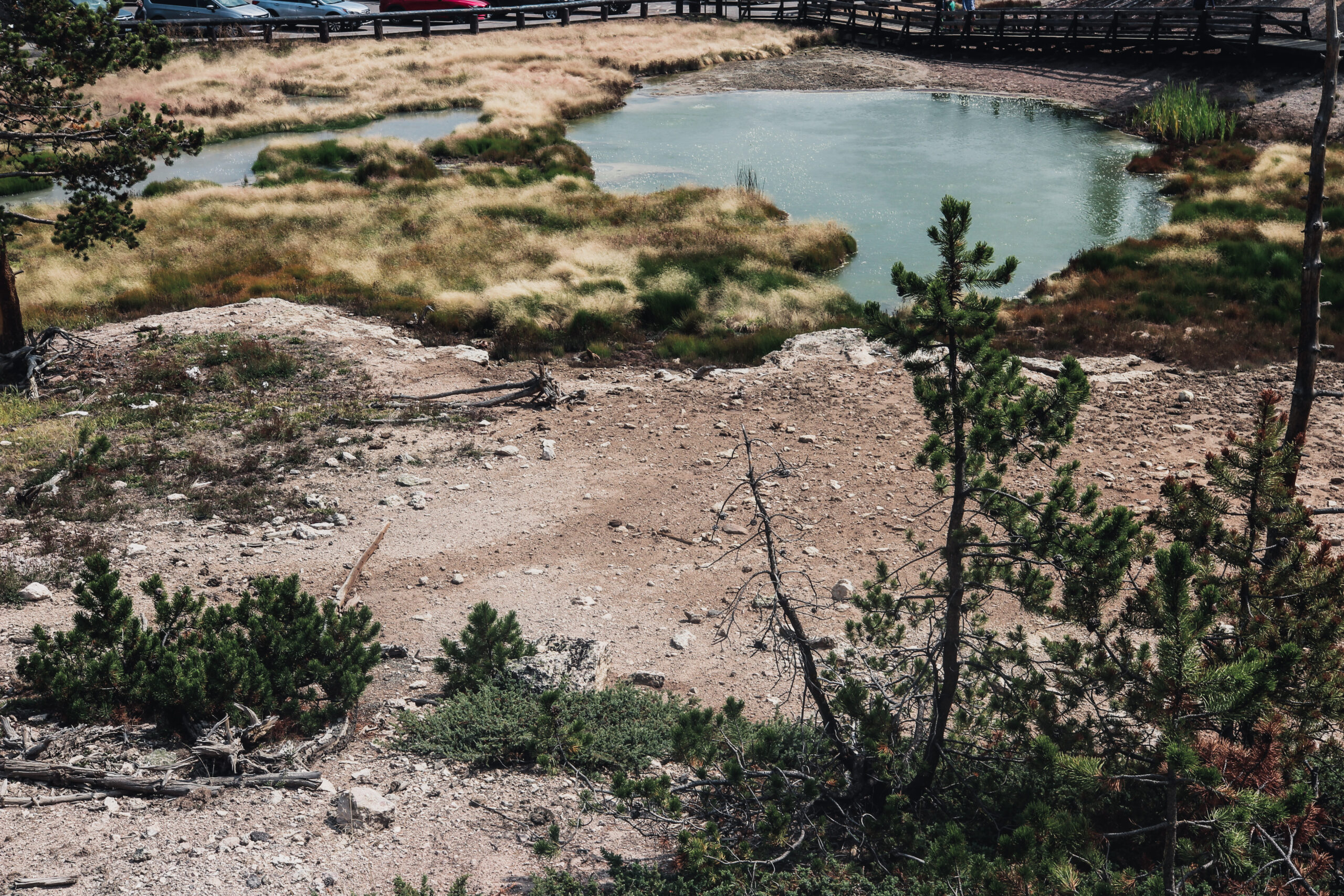
5:30 a.m. never fails when I am camping I am an early riser. Today (August 26th) after a decent cup of brew, Jen and I are heading to West Thumb Geyser Basin Trailhead. This hike is an easy, boardwalk 0.6-mile (1-km) trail through a geyser basin of colorful hot springs and dormant lakeshore geysers situated on the scenic shores of Yellowstone Lake.
West Thumb Geyser Basin overlooks the West Thumb portion of Yellowstone Lake, the largest lake at its elevation in North America. The basin contains some of Yellowstone’s most interesting and beautiful hot springs, but none of its geysers are frequent or predictable.
The following are descriptions of a number of important features you’ll see as you work your way around the basin in a clockwise direction:
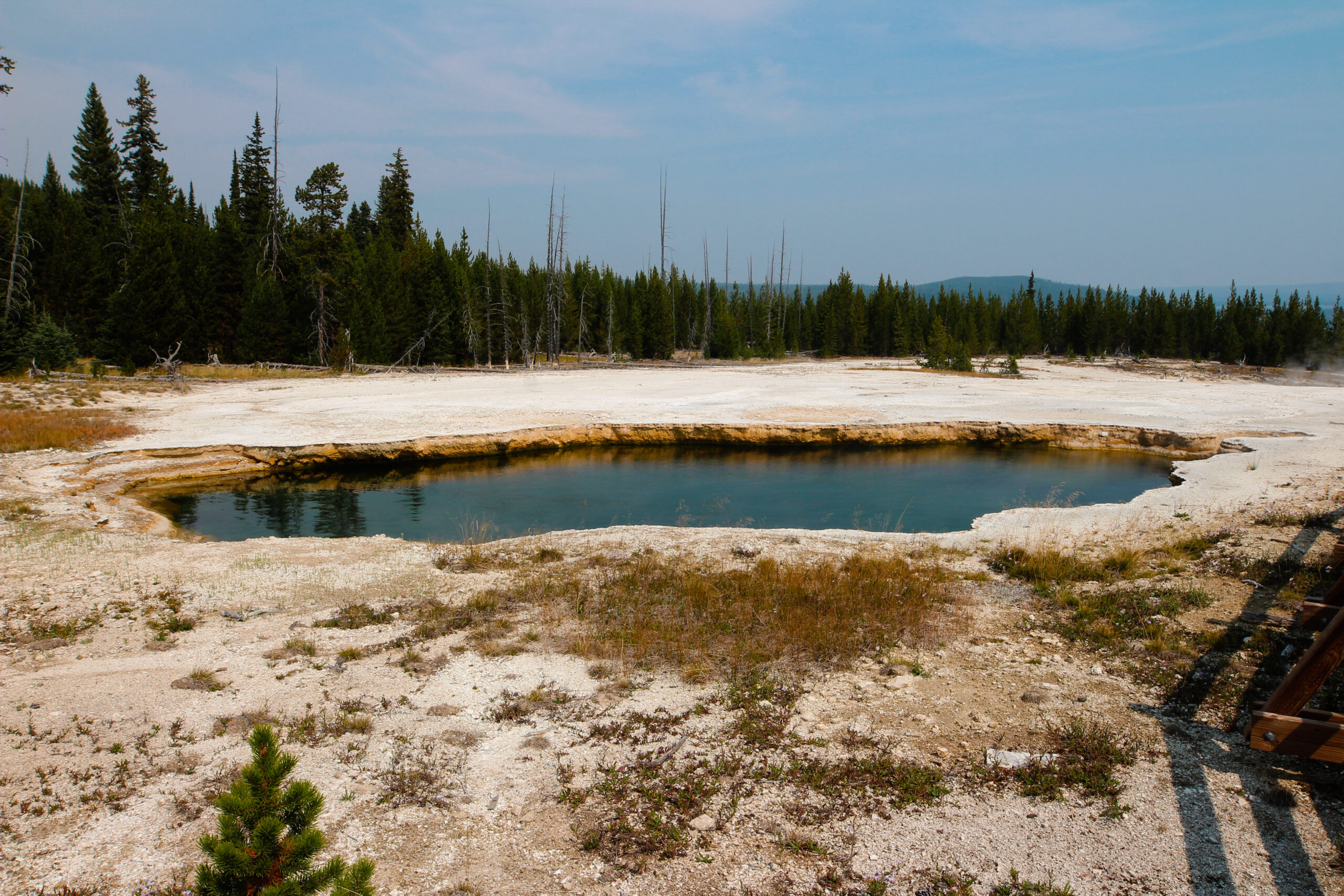
Abyss Pool – One of the deeper hot springs in the park, Abyss Pool descends to 53 feet. It varies from turquoise blue to emerald green to various shades of brown. In 1883, a park visitor described it as “a great, pure, sparkling sapphire rippling with heat.”
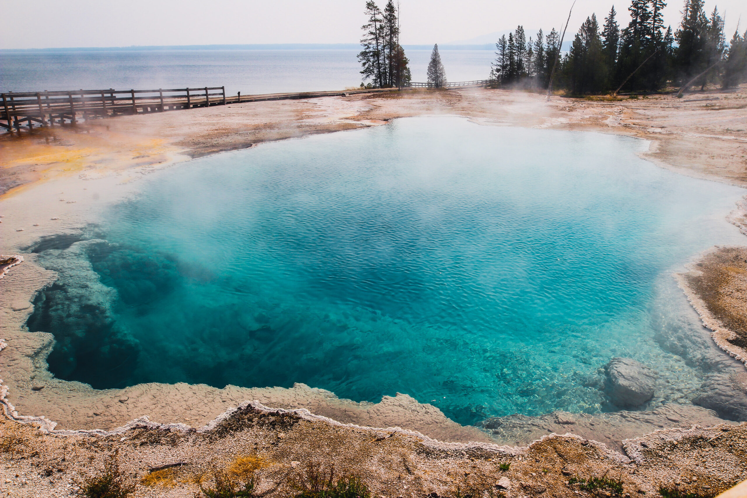
Black Pool – Not long ago, Black Pool really was black. Lower water temperature allowed thick mats of dark green and brown thermophiles (heat-loving microorganisms) to grow in the pool, causing it to appear black. The water temperature rose in1991, killing these organisms. Now it is a stunning clear and deep blue pool. Black Pool also erupted that summer and several times the following winter.
Fishing Cone – Mountain men told of a geyser on the shore of a high alpine lake where one could catch a trout, swing the pole around, dip it into the boiling pool, and cook the fish without taking it off the line. This cooking-on-the-hook feat at Fishing Cone became famous after it was described by a member of the 1870 Washburn Expedition. Visitors often dressed in a cook’s hat and apron to have their picture taken at the “Chowder Pot” or the “Fish Pot.” Anglers often injured themselves while straddling the boiling water, and their feet damaged the geyser’s cone. Fishing is no longer allowed from Fishing Cone.
Lakeside Spring – Its blue-green pool of thermal water drains into Yellowstone Lake. The colors you see in the pools of West Thumb are created, in part, by what grows in these hot waters. Thermophiles have different colors and different temperature requirements. Generally, green and brown indicate organisms living in cooler water, orange and yellow indicate those living in hotter water.
Blue Funnel Spring – This was long known for the distinctive ring of color around its perimeter. However, when Abyss pool began erupting during the winter of 1991-92, the water in Blue Funnel, and in adjacent Perforated Pool and Ephedra Spring, cooled and sank well below the rim. Then the four features appeared to exchange energy: Abyss stopped erupting at the end of that winter, while these features were rejuvenated.