
Approximately 40 wildland firefighters continue to fight off the 24-acre Kolob Terrace Fire, in Hop Valley, Zion National Park. https://www.nps.gov/zion/learn/news/update-wildland-firefighters-continue-to-address-kolob-terrace-fire.htm
August 22, 2019
Just down from Mealt Falls, is the Old Man of Storr, this is probably the most famous walk on the Island and definitely the busiest. The ‘Old Man’ is a large pinnacle of rock that stands high and can be seen for miles around.
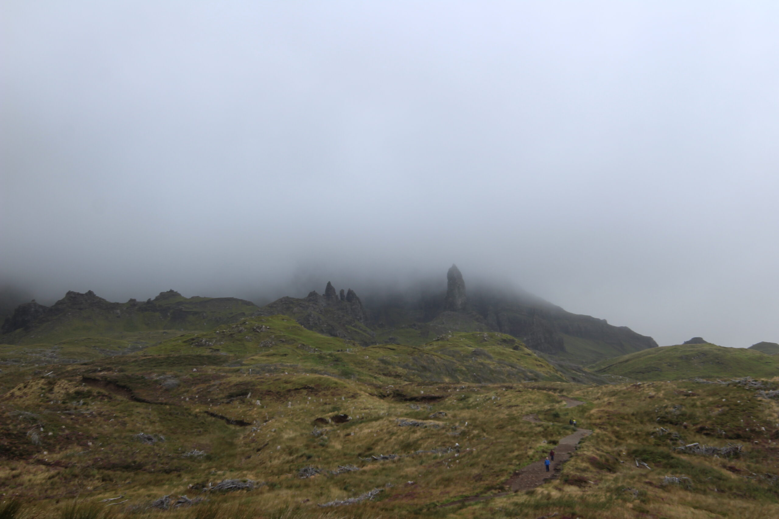
As part of the Trotternish ridge the Storr was created by a massive ancient landside, leaving one of the most photographed landscapes in the world.
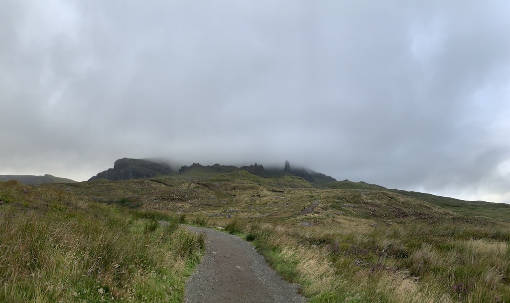
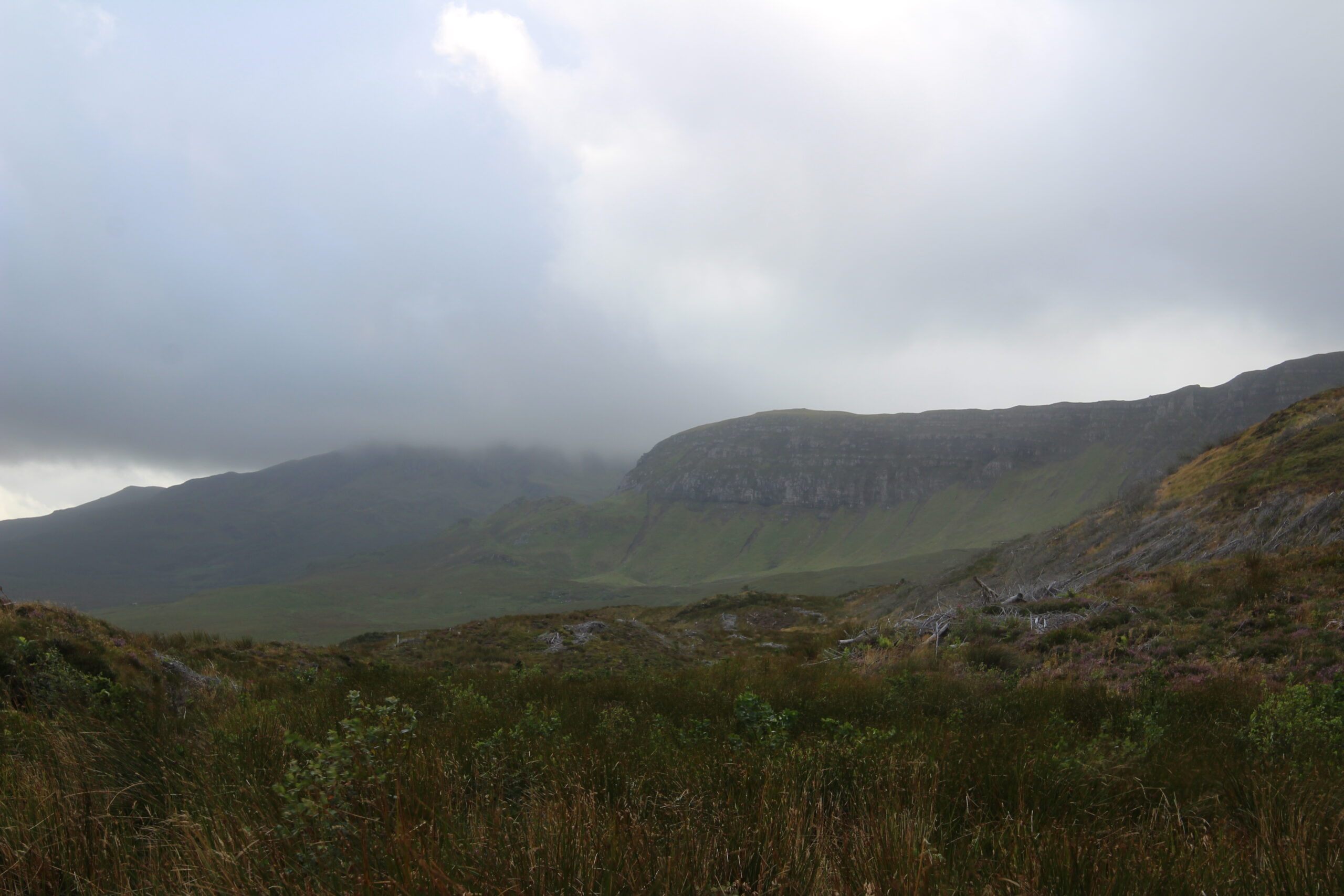
When Jen and I started our hike up, weather really started to move in so we didn’t hike any further up from this point.
The Storr walk uses the same path up and down, starting & returning at the same point (the carpark). It covers a distance of 3.8km, with the average time to complete the walk being 1 hour 15 minutes (with no stops).
We have classed this walk as ‘Medium’ in length and ‘Medium’ for difficulty, check the rating guide for details.
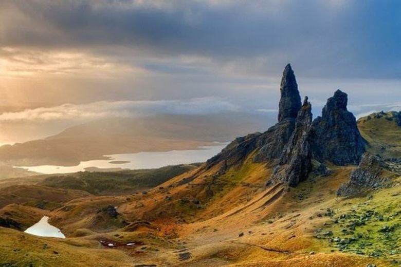
Here is what Old Man Storr looks like in better weather.
Location
The Old Man of Storr is located on the north of Skye in the area known as ‘Trotternish’. The start of the walk is by the main road from Portree to Staffin.
Weather
This walk is suitable in most weather conditions. The top section of the path can get muddy on a wet day.
Parking
The carpark is located right by the main road 6.8miles from Portree which will take about 10 minutes to drive.
The carpark is not that big so fills up quickly mid-summer, there is an extended layby to the main road that continues from the carpark entrance.
The Walk
From the carpark look uphill and you will see ‘Old Man’ and the high cliffs that surround. Getting to the foot of the ‘Old Man’ will take about 45 minutes, longer if you stop for rests.
The first stage of the walk used to pass though farmed pine woodland, but recently it has been harvested (cut down). The path has now been repaired with a new layer of gravel as it passes through these lower slopes where the forest was.
The top section of the walk on the approach to the Old Man (the rock pinnacle) is a lot rougher as the path is in poor condition.
Make sure your look through the Walk SlideShow, as it give a step by step account of what you will encounter.
Stage 1
At the end of the carpark there is a wooden gate. Head though the gate and follow the gravel path that curves up the hillside.
You will see the remains of the recent fallen trees and the start of the replanting of this commercial Forrest.
After a while the gravel path splits. Both options re-join higher up the slope, we recomend taking the right hand side option.
The Path is steep in places but clear in direction. You will reach a wooden gate, pass through (closing the gate behind you).
Follow thje path as is zig zags up the hill, reaching another woodend gate. This gate is double height, designed to keep deer out. Close the gate as you pass though and continue up hill.
The path then levels out (for now).
Stage 2
Now clear of the old forest area, continue along the gravel path.
Ahead you will see a small wooden gate. On the left hand side of the gate there is a small pond that was created for an emergency source of water in case of forest fire.
Pass through the gate. The new gravel path ends and immediately can be muddy on a wet day.
The slope ahead is now grassy with the well-worn path climbing up the slope.
Working your way up the slope your will find the path rough and rocky, take a break often to get your breath and to enjoy the views ahead of the incredible cliff face and the interesting rock structures.
When half way up the steep slope the path splits in two, take the left hand side option (as you face uphill).
Stage 3
Follow the left hand split in the path and work your way uphill. There are uneven rock steps on the path.
As you continue uphill the ‘Old Man’ will be on your far right side. Ahead are many other rock formations.
The path now turns right to face the Old Man and continues with more uneven rock steps.
Now on the final approach to ‘the Old Man’ the path curves uphill heading for the foot of the rock pinnacle.
The Old Man of Storr
The foot of the Old Man becomes very steep and a bit of a scramble, not suitable for all. If you wish to get to the very top then continue with care.
The SlideShow photographs gives a very care account of the final section of the walk, please look though the photos.
From the top the views are fantastic, look out to sea over the Islands of Raasay and Rona and then beyond to the mainland. Looking South there are views of the ‘Storr Lochs’ and then on to Portree and the Cuiliin Hills. Get your camera out for a few shots, then maybe find a quiet corner for a spot of lunch.
For the braver walkers carefully explore the other rock structures that neighbour the Old Man.
Stage 4
Heading back uses exactly the same route, but is far easier going as it is all downhill; allow 30-40 minutes to get back to the carpark.
Leave a Reply
Related Posts
198